Close Menu

    Closings

    Facebook X (Twitter) Instagram
    • Personalities/Staff
    • Jobs
    • Calendar
    • Contest Rules
    • Contact Us
    • Privacy Policy
    • Login
    RSS Facebook X (Twitter)
    News Radio KMAN
    • Local/State News
      • Manhattan
      • Wamego
      • Riley County
      • Pottawatomie County
      • Fort Riley
      • Geary County
      • State News
      • RCPD Reports
    • Weather
    • Sports
      • K-State Sports
      • High School Sports
        • HS Basketball Schedule & Scores
          • Manhattan High
          • Wamego
          • Rock Creek
          • Riley County
          • Frankfort
          • Blue Valley High
      • Scoreboard Saturday
      • Student-Athlete of the Week
    • Podcasts
      • Within Reason with Mike Matson
      • The Game
      • Wildcat Insider
      • Scoreboard Saturday
    • Obituaries
    • Message Us
      • Birthday/Anniversary
    • Keep It Local
    Listen
    Closings And Delaystyle=
    News Radio KMAN
    You are at:Home»Local News»THE LATEST: Warmer than expected temperatures dampen ice storm severity

    THE LATEST: Warmer than expected temperatures dampen ice storm severity

    0
    By KMAN Staff on January 11, 2017 Local News, Top Story
    Ice forms on a tree in Manhattan Sunday afternoon. (Staff photo by Brady Bauman)
    Ice forms on a tree in Manhattan Sunday afternoon. (Staff photo by Brady Bauman)

    UPDATED: Sunday, 3:31 p.m.

    Weather officials continue to downgrade ice accumulations predicted for the Manhattan area. What was worried would be a repeat of the 2007 ice storm going into the weekend turned into significantly less as warmer than expected temperatures staved off what easily could have been.

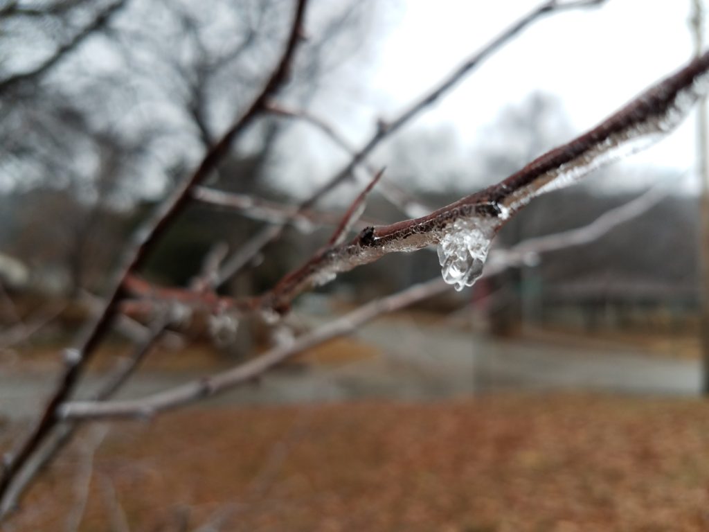
    Of course, Manhattan residents who remember the damage the 2007 storm caused — substantial tree damage and some homes without power for a week or more — the concern was justified.

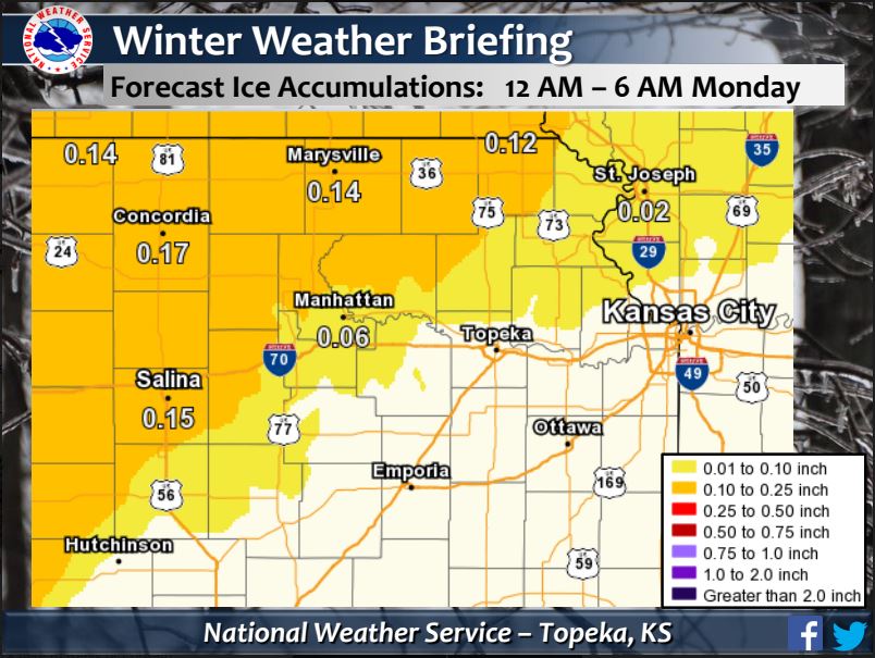
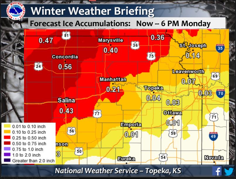
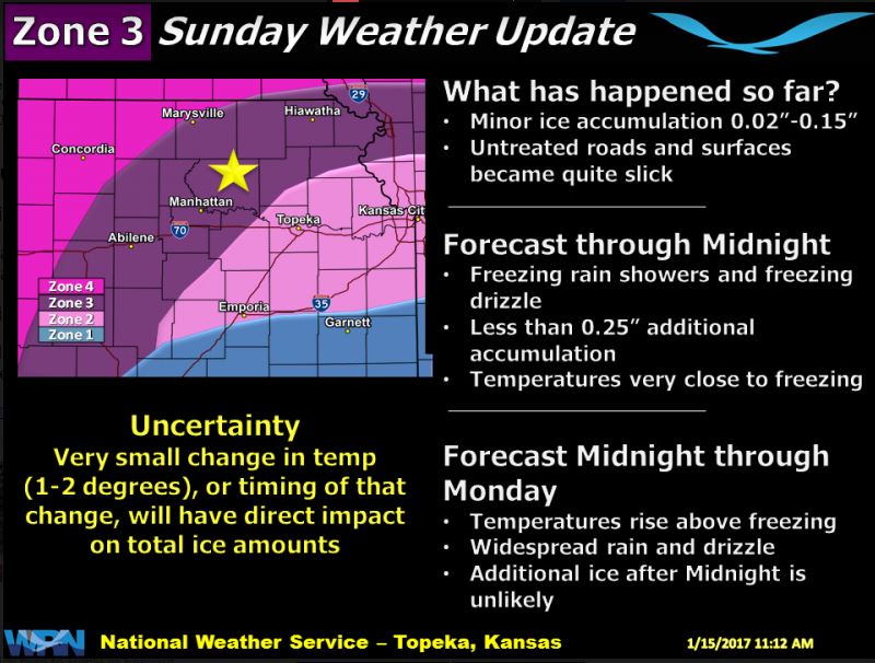
    Updated forecasts show light freezing rain through Sunday night into Monday. An Ice Storm Warning was issued Friday for much of the state until Sunday at midnight. Officials with the National Weather Service in Topeka say things can change, however, depending on a slight degree deviation above or below freezing. It was 33 degrees Sunday afternoon in Manhattan with a low of 29 degrees predicted for 8 p.m. Temperatures are expected to rise, though, back up to 33 degrees at midnight. A high of 38 degrees is forecast for Monday in the Little Apple.

    #Ice Accumulation Amounts as of 3 PM Sun: 0.2″-0.5″ across portions of north central and east central KS. Watch out for slick roads! #kswx pic.twitter.com/WzWBM9bPFa

    — NWS Topeka (@NWSTopeka) January 15, 2017

    The latest cancellations, closings and postponements can be found on the right margin of your screen.


    Share. Facebook Twitter Pinterest LinkedIn Tumblr Email
    KMAN Staff
    • Website
    • Facebook
    • X (Twitter)

    Related Posts

    Local refugee resettlement team’s funding in jeopardy

    Multiple cooling shelters open amid heatwave

    Riley County officials responding to uptick in overdose-related ER visits

    Listen Live Here
    Listen Live - Mobile

    Categories

    EEO Report

    FCC Public File

    FCC Applications


    Follow @1350kman on Twitter · Manhattan Broadcasting Company is an equal opportunity employer.
    Manhattan Broadcasting does not discriminate in sale of advertising on the basis of race, gender, or ethnicity, and will not accept advertising which does so discriminate. © 2024 Manhattan Broadcasting Company.

    Type above and press Enter to search. Press Esc to cancel.