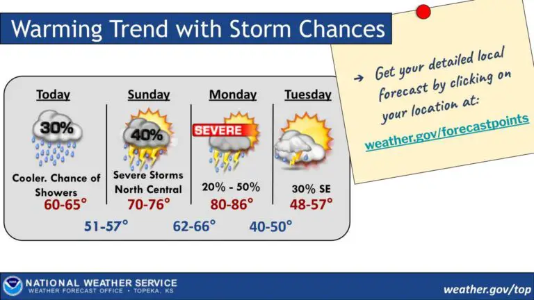
Cloudy and cool conditions are expected today, with isolated to scattered showers developing across the area from west to east. Rain and storm chances will increase tonight and continue into Sunday morning.
Thunderstorms are forecast to redevelop Sunday afternoon and overnight, with some storms in north central Kansas potentially becoming strong to severe.
An upper-level storm system will lift northeast across the Plains on Monday, bringing another round of showers and thunderstorms, particularly along a dryline in the afternoon and evening. Severe storms on Monday could produce all types of severe weather hazards.
A cold front will move through Monday night but may stall across southeastern counties, keeping a chance for showers and storms in the forecast for Tuesday. Temperatures are expected to warm into the 80s on Monday ahead of the front.

