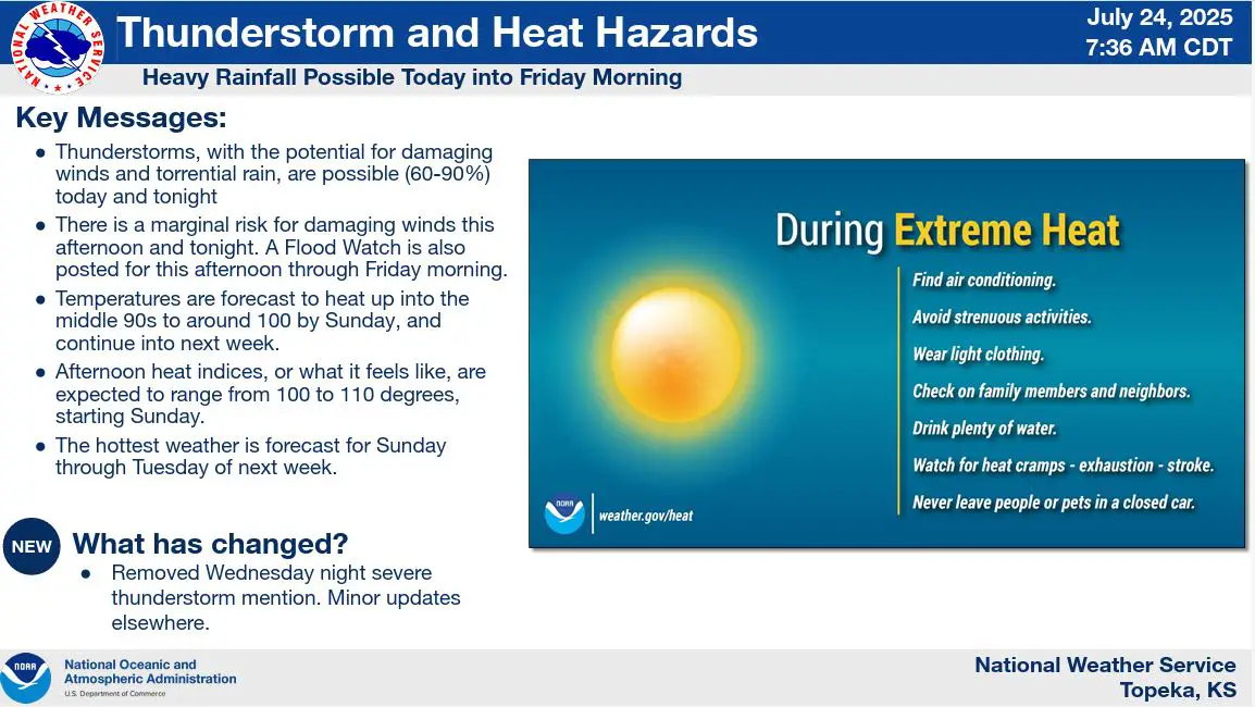
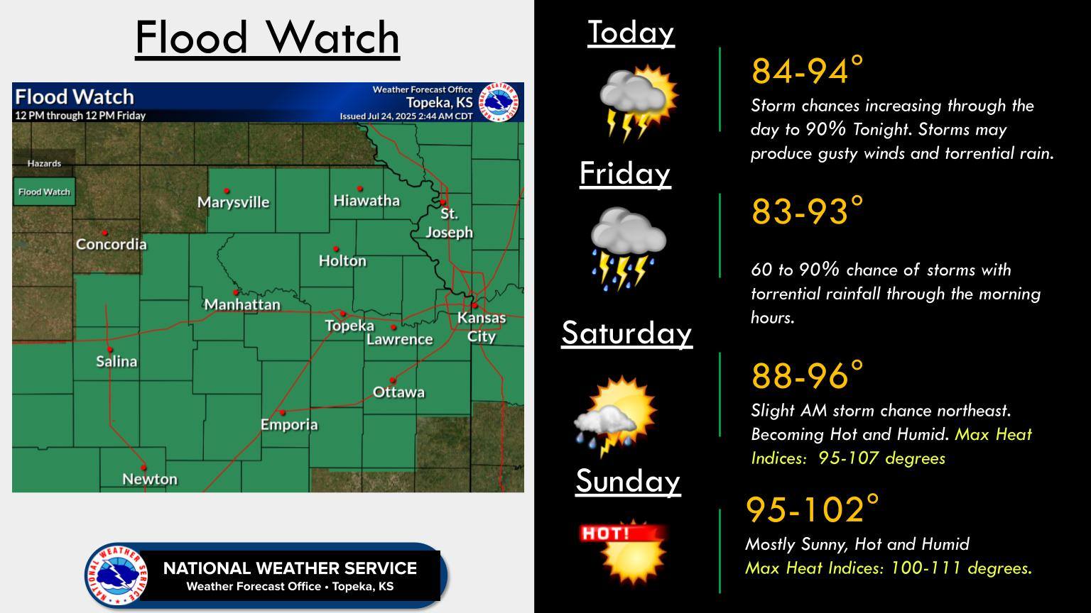
A flood watch is in effect from noon Thursday through noon Friday as forecasters warn of the potential for severe weather and heavy rainfall across the area.
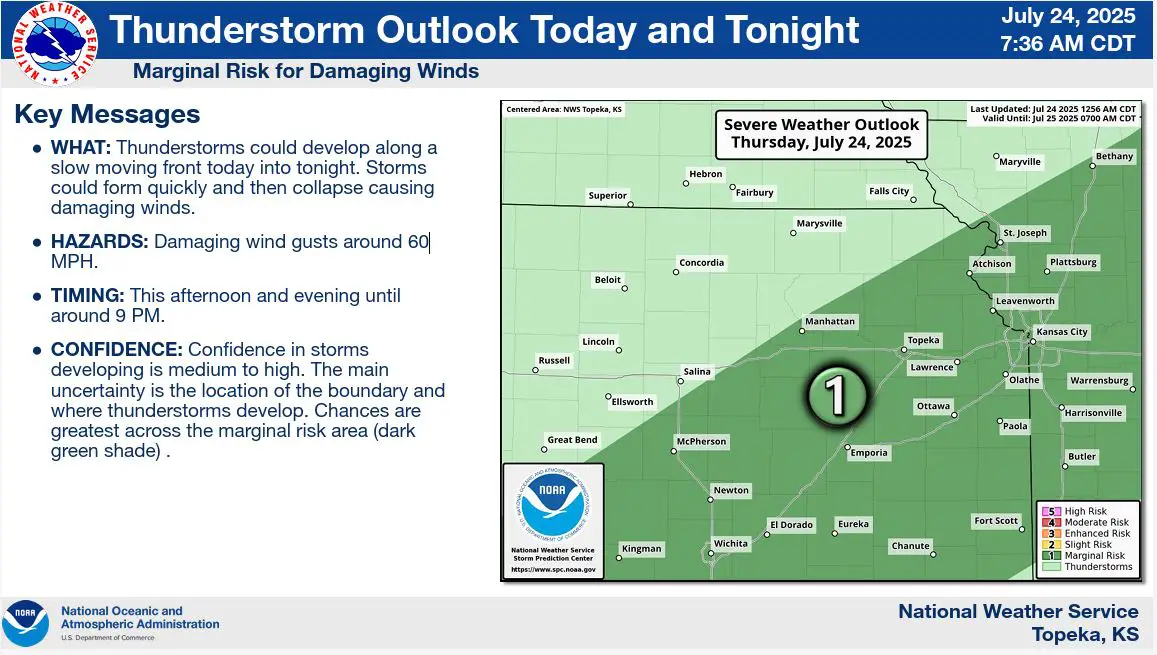
Showers and thunderstorms are expected to develop this afternoon and evening, with isolated wind gusts reaching 50 to 60 miles per hour. The storms may also bring heavy downpours, increasing the risk of localized flooding.
The most significant rainfall is anticipated overnight Thursday into Friday morning, with storms continuing to impact the region before moving northeast by Saturday morning.
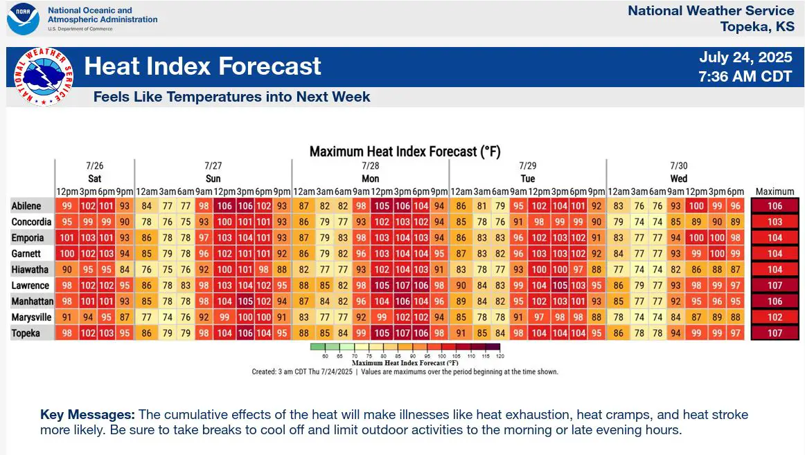
In the wake of the storms, hot and humid conditions are expected to build across the area beginning Sunday and lasting through early next week. Heat indices are forecast to range between 100 and 112 degrees from Sunday through Tuesday, prompting concerns for heat-related illnesses.
Stay tuned to News Radio KMAN for the latest updates.