Residents across northeast Kansas could see a wide range of weather conditions this weekend, including elevated fire danger, strong winds and the possibility of light snow, according to the National Weather Service in Topeka.
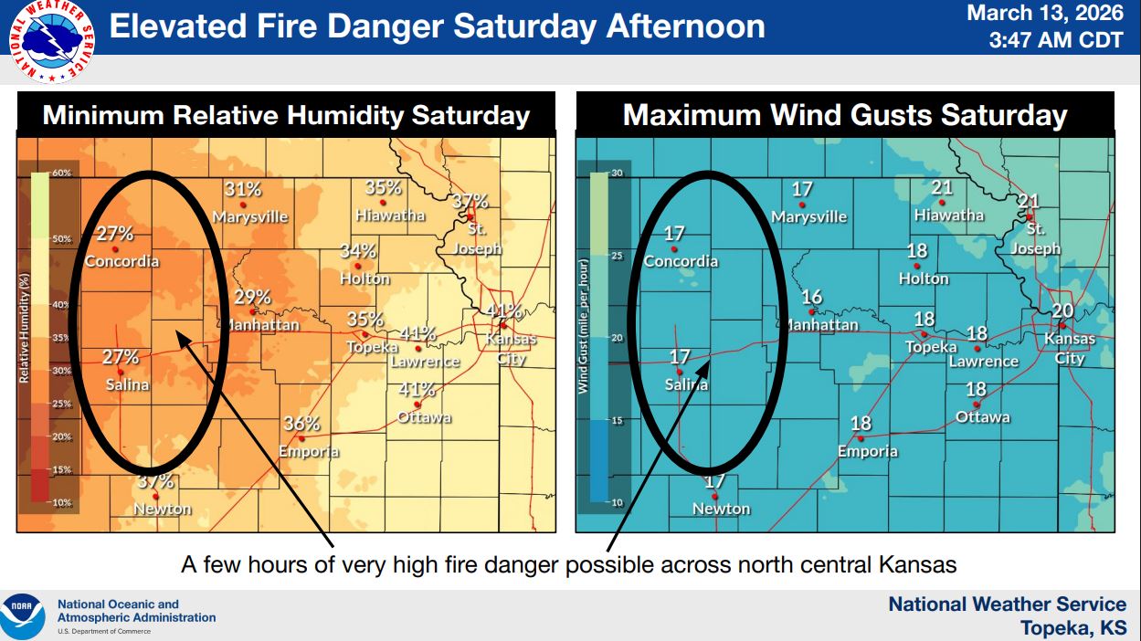
Saturday afternoon brings an elevated fire danger, particularly across north-central Kansas, as dry air and breezy conditions combine to create conditions favorable for fire spread. Forecasters say relative humidity levels could fall into the 25–35% range, increasing the risk for rapidly spreading fires during the afternoon hours.
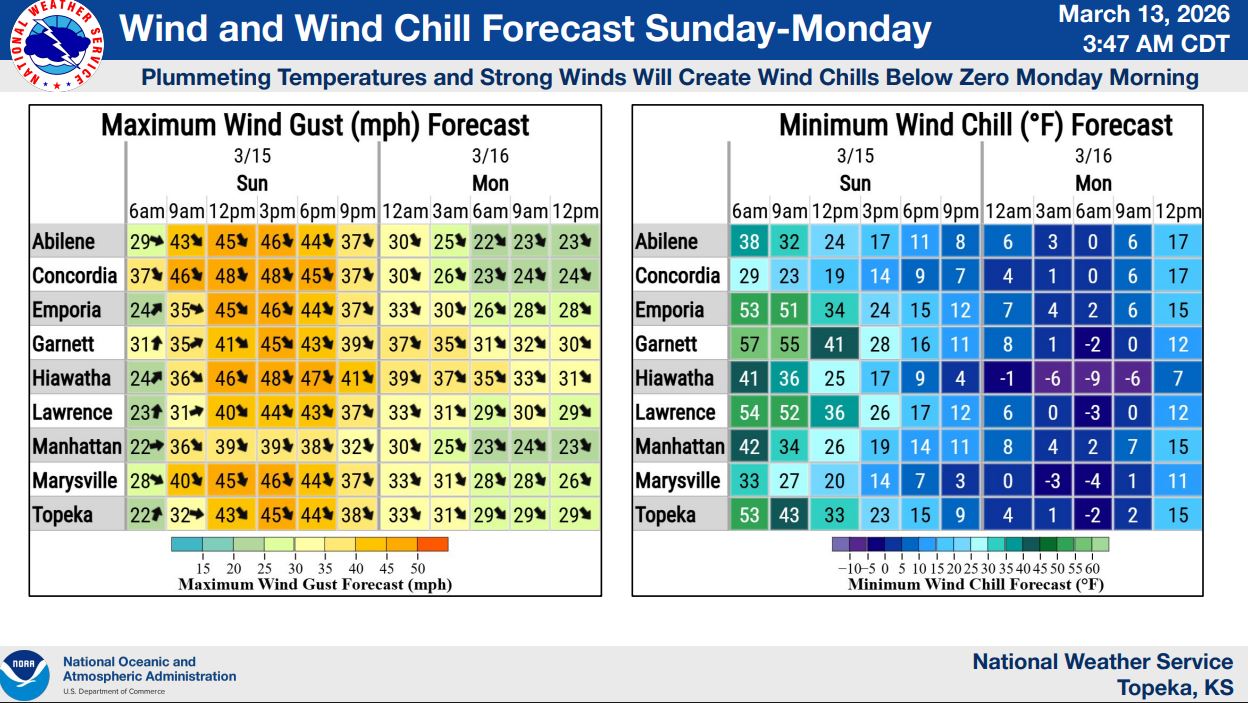
Weather conditions will change quickly on Sunday as a cold front moves through the region. Meteorologists expect northwest winds sustained at 30 to 35 mph with gusts of 40 to 50 mph, with a smaller chance of gusts approaching 60 mph. The strong winds could blow around unsecured outdoor items and make travel difficult at times.
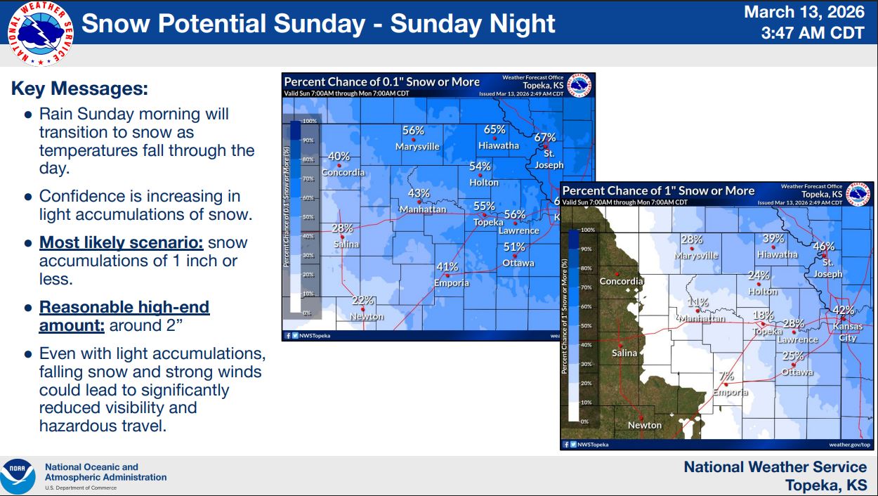
Rain is expected to develop Sunday morning before transitioning to light accumulating snow as colder air moves into the region during the day. Forecasters say the most likely scenario is less than 1 inch of snow, though isolated areas could see up to around 2 inches.
Even with light snowfall amounts, strong winds and falling snow could reduce visibility and create hazardous travel conditions, especially Sunday evening.
Temperatures will drop sharply after the front passes, and wind chills could fall below zero by Monday morning, bringing a brief return to winterlike conditions before warmer weather returns later in the week.