 Updated Monday 6:45 a.m.–interview with Brian Barjenbruch with National Weather Service in Topeka who says the slightly above freezing temperature overnight helped the Manhattan area–but it’s not over yet:
Yvonne Etzel, Westar Energy:
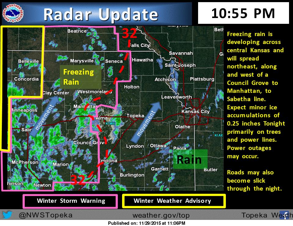
(Photo courtesy National Weather Service, Topeka)Freezing rain will move northeast along and west of a Sabetha, to Manhattan, to Council Grove through tonight. 0.25 inches of ice may accumulate on elevated objects, power lines and tree limbs. The additional ice accumulations through Monday morning may cause tree branches and power lines to snap. Roads may become icy in the winter storm warning area overnight and through the morning hours of Monday. Temperatures across east central Kansas should remain steady in the mid 30s, thus only rain is expected for east central Kansas through the night.
Many schools are closed and activities canceled for Monday. For the latest, please check our closings page.