
Update 11 a.m. Sunday
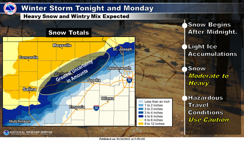
Much uncertainty remains over when and how much snow will fall in the Manhattan area, but forecasters believe it will be a significant storm for the area regardless.
The National Weather Service in Topeka says the storm system will bring several inches of snow as well as minor ice accumulations beginning late Sunday night into the day on Monday. Travel may be difficult Monday when the heaviest snowfall is expected to occur, with poor visibilities.
The latest models show Manhattan and Junction City straddling the line of where some of the biggest snowfall amount uncertainty exists. Approximately 4 to 8 inches of snow could fall in areas of Riley, Geary and Pottawatomie counties depending on the track of the storm. Those counties remain in a Winter Storm Watch late tonight through Monday afternoon. Bordering counties, including Clay, Marshall and Washington are in a Winter Storm Warning for locally heavier amounts in the forecast.
Weather related cancellations, closings and delays will be shared via the KMAN Closings and Delays page.
Original story 4:30 p.m. Saturday
Manhattan has largely avoided much of Old Man Winter this season, but that could change as a winter storm bears down on much of north central Kansas and the Central Plains region Sunday night into Monday.
The National Weather Service has issued a winter storm watch for the Manhattan area, including Riley, Geary, Pottawatomie and Wabaunsee counties from late Sunday night through Monday afternoon.
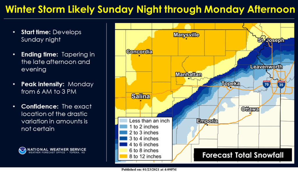
Significant snowfall is likely for much of the area, with forecasters predicting 8 to 12 inches of snow in areas from Salina to Holton. That extends to portions of northern Riley and Pottawatomie counties. Manhattan could see between 6 to 8 inches if the forecast models hold true.
Light drizzle and freezing drizzle are possible Sunday evening with precipitation changing over to a wintry mix of light freezing rain and snow overnight then to mostly snow north of Interstate 35 Monday morning through late afternoon. Heavier snow amounts are expected further north, according to the Weather Service.
Travel could be treacherous, so those planning to travel Sunday or Monday, should likely consider alternative plans. The peak times for snowfall are forecasted to be between 6 a.m. and 3 p.m. Monday.
Be sure to check KMAN’s Closings and Delays page for updates and announcements as they become available.