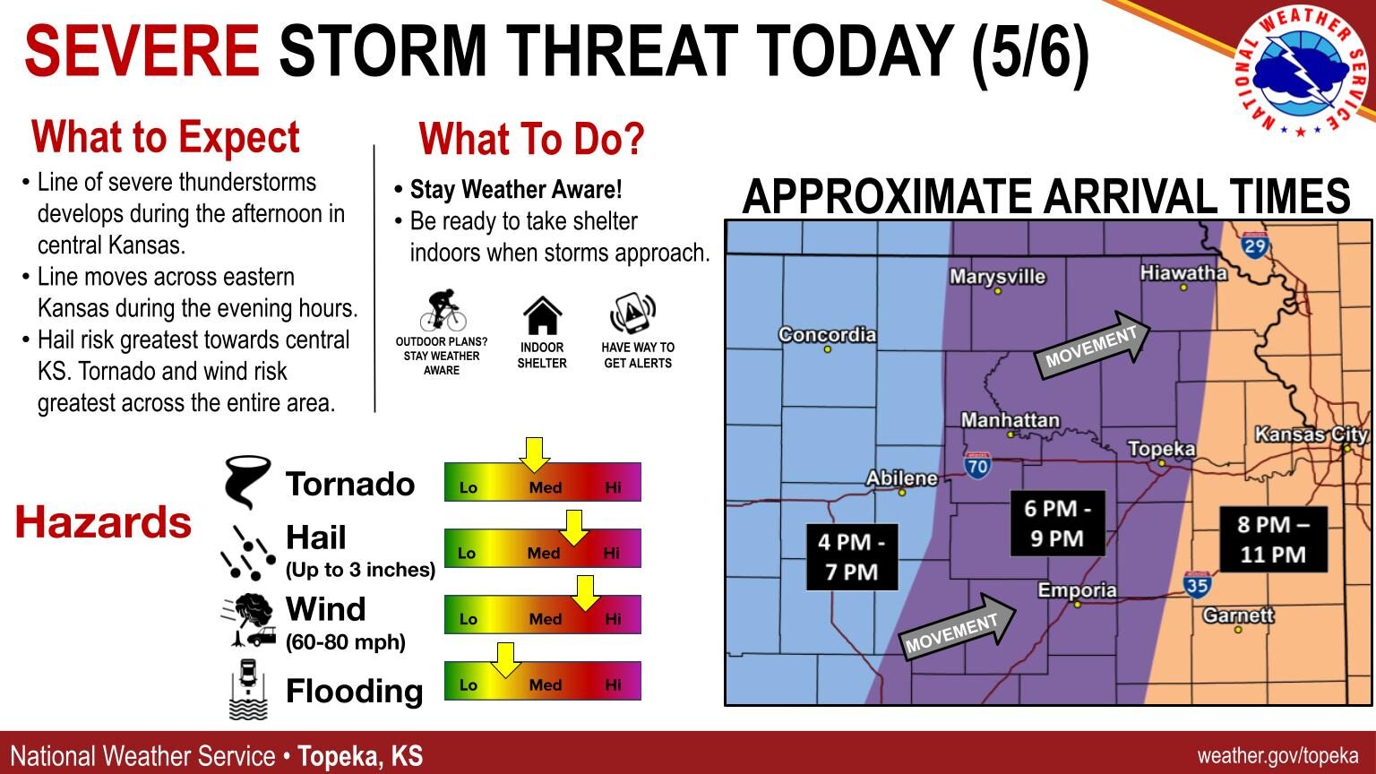
Severe weather appears to be likely for Monday with showers and thunderstorms expected to pop up this afternoon and evening.
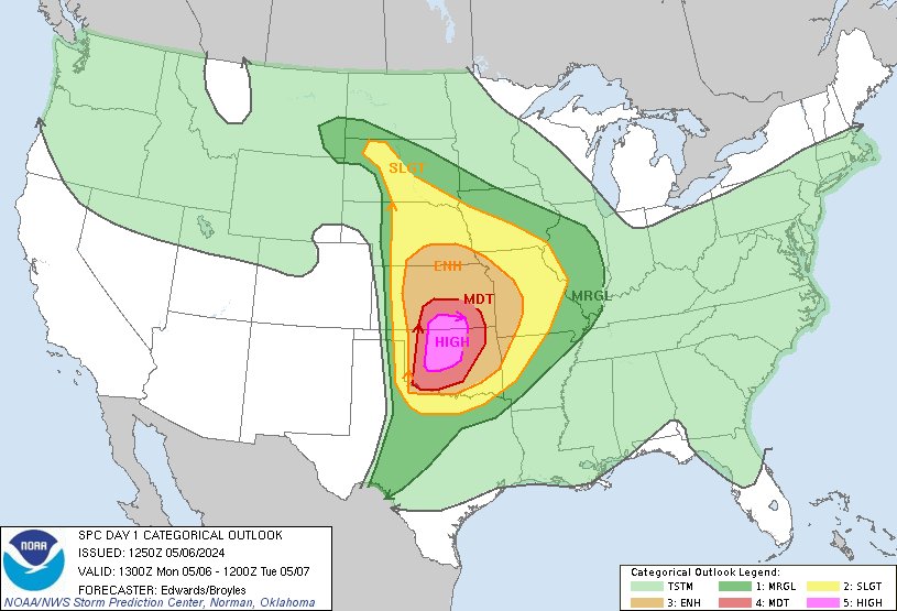
The Storm Prediction Center has placed the Manhattan area in an enhanced (level 3) risk for storm development, noting the potential for large hail, damaging winds and tornadoes. National Weather Service meteorologist Sarah Teefey…
Teefey says having low clouds this morning should help somewhat but warns there is still plenty of instability.
Timing for storm activity in the Manhattan area appears to be in the evening from about 6 to 9 pm.
Areas further to the south, including southern Kansas and northern Oklahoma are in a moderate (level 4) risk for storm development. Extreme southern Kansas, including Cowley, Harper and Sumner counties as well as extreme northern Oklahoma are in a high risk (level 5) for storm development.
NWS Storm Prediction Center graphic
Original story 11 a.m. Sunday
All modes of severe weather will be possible Monday, as an active weather pattern continues for the Flint Hills Region.
Showers and thunderstorms are now likely for much of the region Monday afternoon and evening, with both the National Weather Service offices in Topeka and Wichita mentioning concerns about a potential severe weather outbreak. Storms could bring large hail, damaging winds and a few tornadoes.
The Storm Prediction Center has placed much of Kansas in an enhanced risk (level 3) for storm development in the afternoon and evening hours. Areas of southern Kansas, including Wichita, are in a moderate risk (level 4) for storm development.
Weather officials from both offices say there are some possible limiting factors, including low-level wind shear and storm interactions.
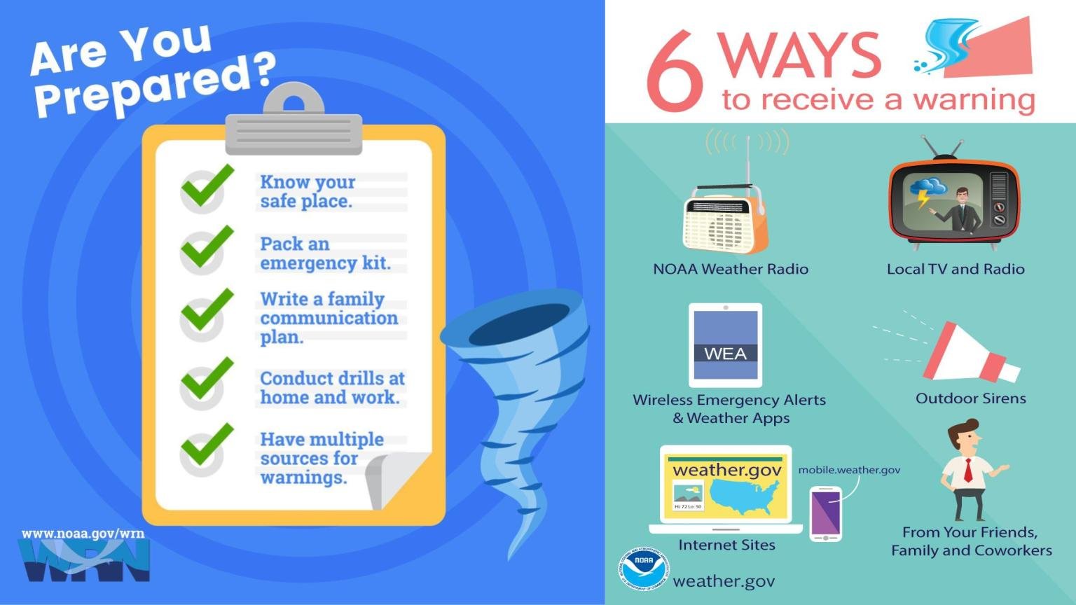
The public is advised to be weather aware and have a safety plan in place.