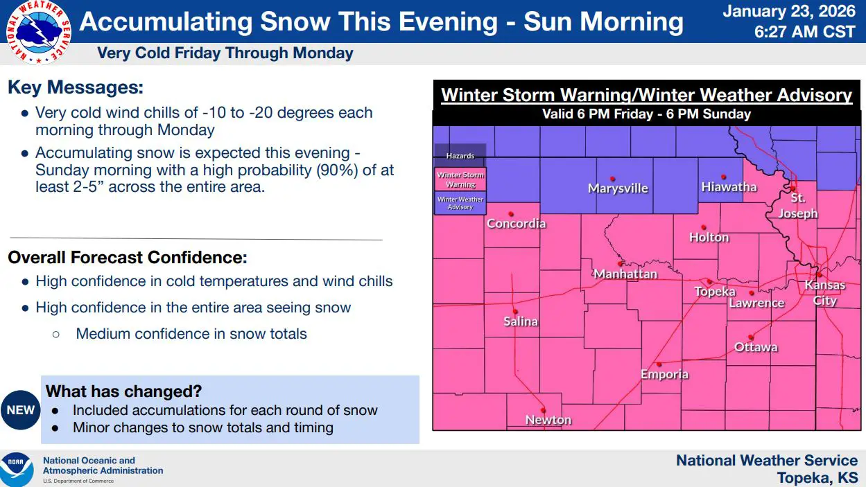
A winter storm is expected to impact much of northeast and east-central Kansas from Friday evening through early Sunday, bringing accumulating snow and dangerously cold temperatures, according to the National Weather Service in Topeka.
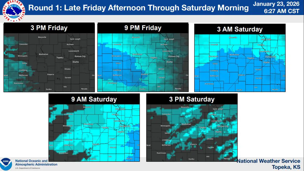
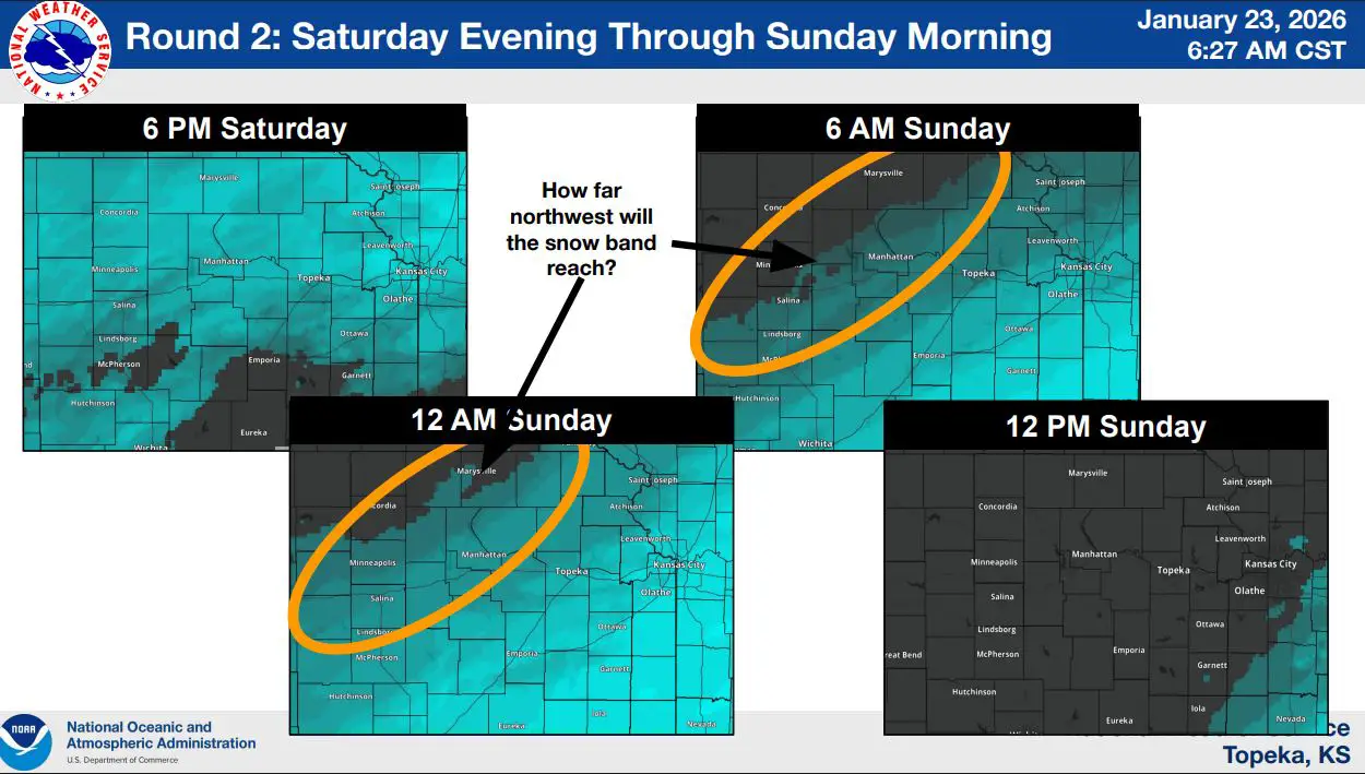
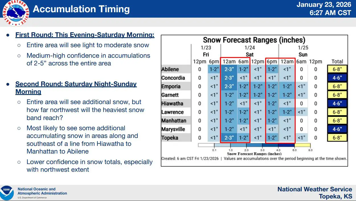
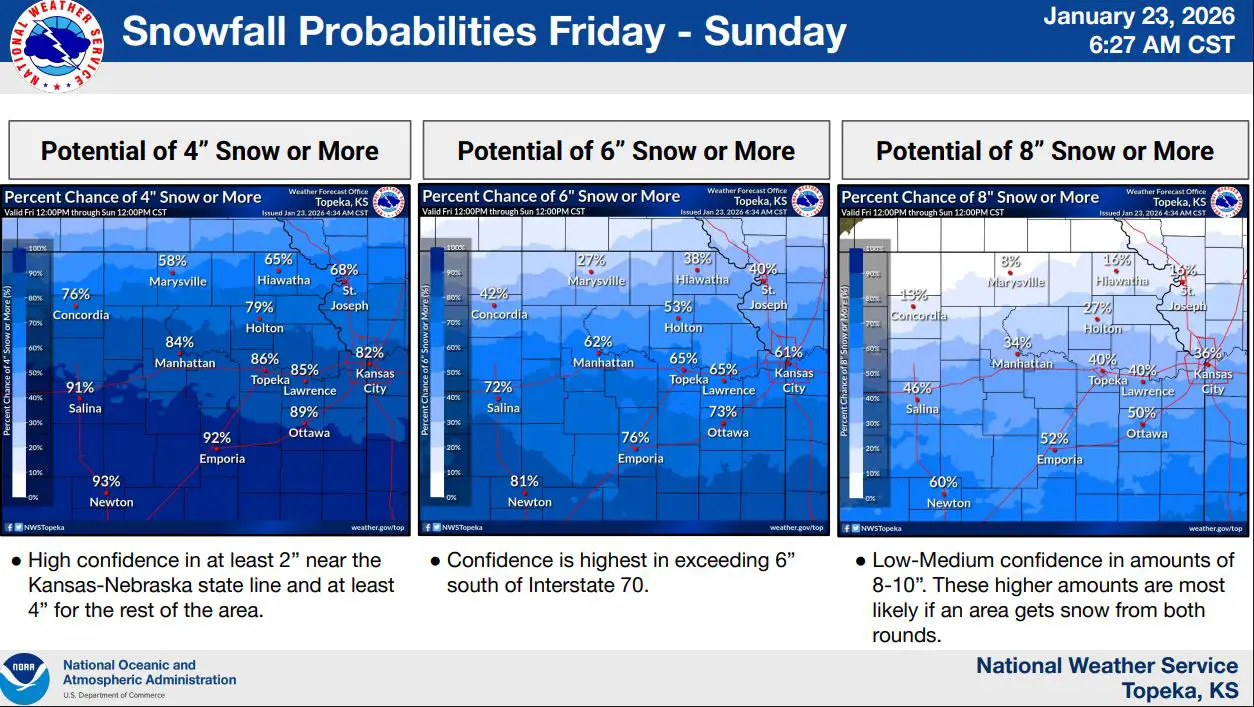
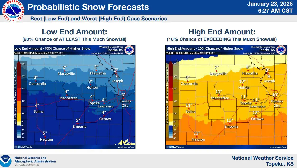
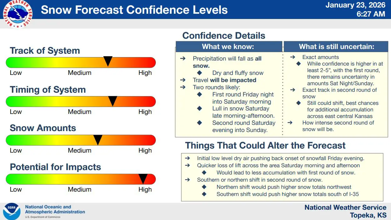
Forecasters say snow will begin late Friday afternoon and continue into Sunday morning, with two rounds of heavier snowfall likely. The first round is expected Friday night into Saturday morning, followed by a second round Saturday night into Sunday. Manhattan is expected to see 6 to 8 inches of snow, while most of the region has a high probability of receiving at least 2 to 5 inches of snow.
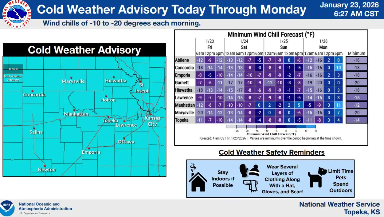
In addition to the snow, very cold air will settle across the area. Wind chill values are forecast to range from minus 10 to minus 20 degrees each morning through Monday, creating potentially dangerous conditions for anyone spending extended time outdoors.
Travel is expected to be impacted throughout the weekend, as light and fluffy snow accumulates on roadways. Officials warn that even modest snowfall amounts could lead to slick conditions, especially on bridges and overpasses. Residents are encouraged to limit travel when possible and prepare for prolonged cold by dressing in layers and checking on vulnerable populations.