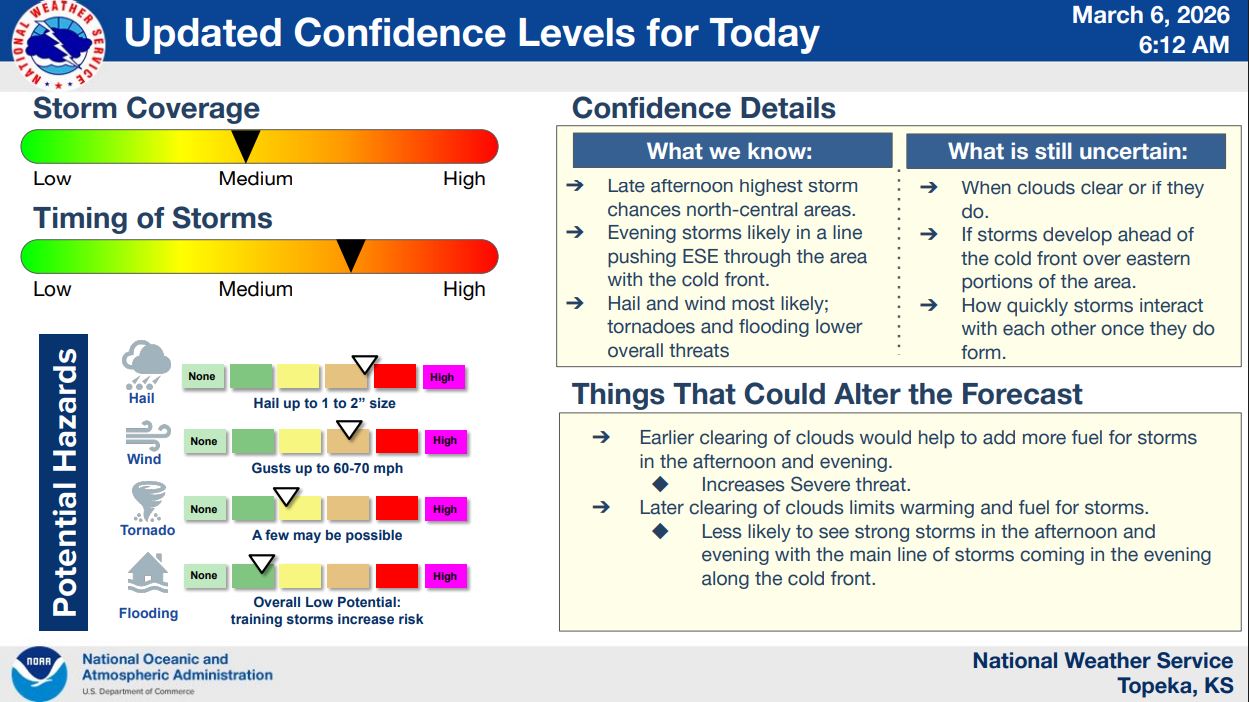
Strong to severe thunderstorms are possible across northeast Kansas Friday afternoon and evening, according to the National Weather Service in Topeka.
Forecasters say storms could begin developing between 4 p.m. and 7 p.m., initially forming as individual storms or supercells before transitioning into a line of storms later in the evening. That line is expected to move east-southeast through the region and exit the area around midnight.
The entire region could see storms if cloud cover clears enough to allow additional warming during the day. Meteorologists say the most likely area for early supercell development is trending toward north-central Kansas before storms organize into a larger system as a cold front pushes through.
Damaging winds and large hail appear to be the primary threats. Hail up to 1 to 2 inches in diameter and wind gusts as high as 60 to 70 mph are possible. A few tornadoes cannot be ruled out, though that risk remains lower. Flooding potential is also considered relatively low unless storms repeatedly move over the same areas.
Forecasters say confidence in storm timing and overall development is medium to high, but the exact severity will depend on how quickly clouds clear during the day and how storms interact once they form.
Residents are encouraged to stay weather aware Friday and make sure they have multiple ways to receive warnings as storms move through the region. Stay tuned to News Radio KMAN for the latest updates. 93.3fm, 93.7fm, 1350am or 1350kman.com/listen.