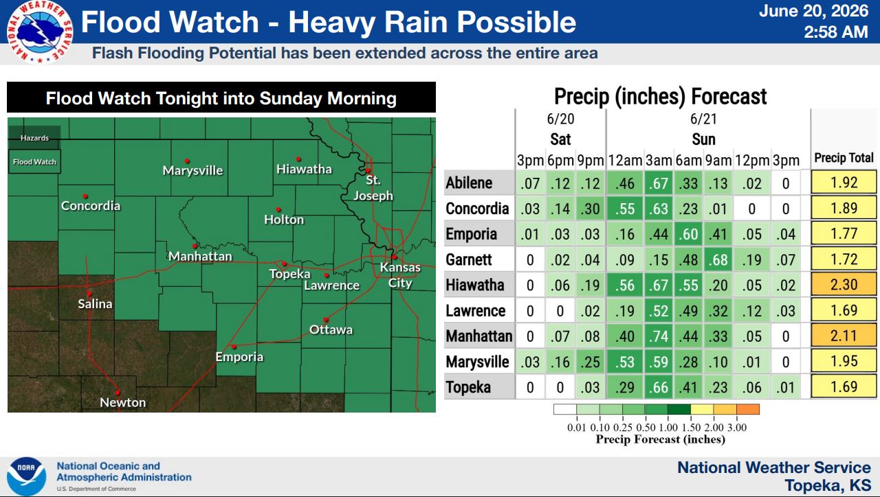
The National Weather Service has expanded a Flood Watch to include all of northeast Kansas as confidence grows in the potential for heavy rainfall and flash flooding Saturday night into Sunday morning.
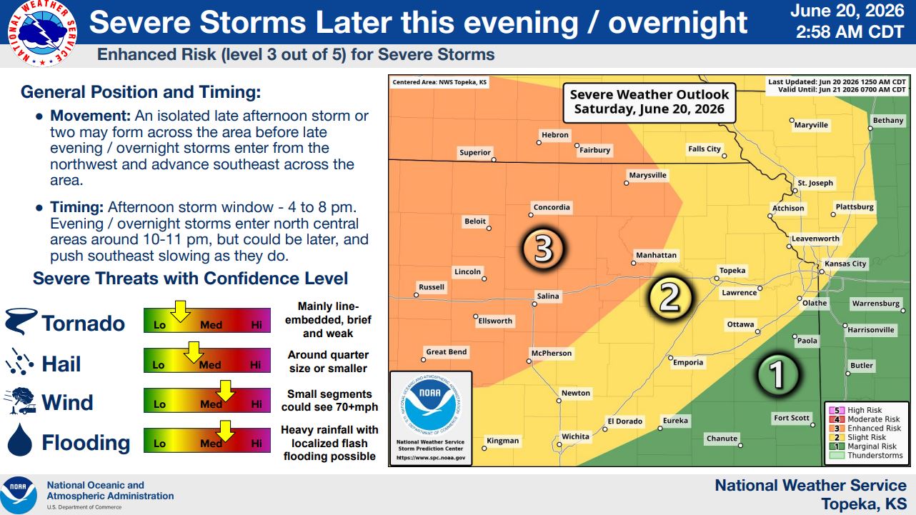
An Enhanced Risk (Level 3 of 5) remains in effect for severe storms Saturday evening and overnight. Damaging winds up to 70 mph, quarter-sized hail, localized flooding and a low-end tornado threat are possible.
Isolated storms may develop between 4 and 8 p.m., with the main storm complex expected to arrive between 10 and 11 p.m. and continue through the overnight hours.
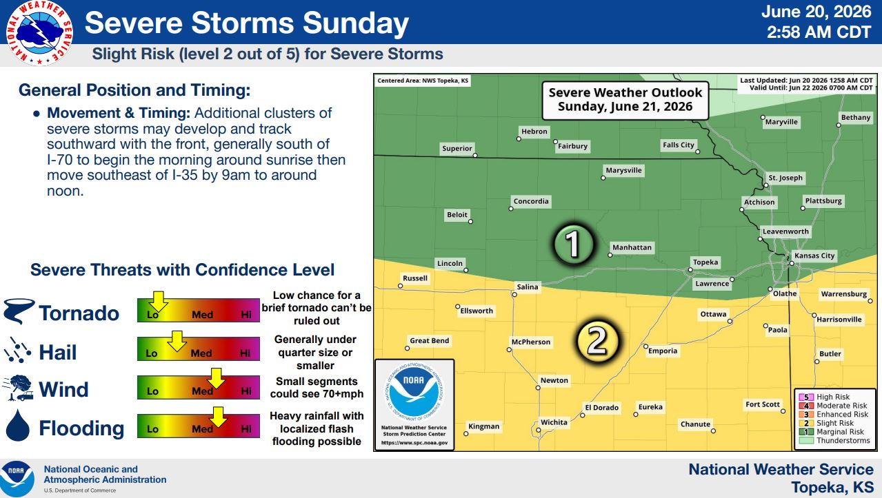
Additional severe storms are possible Sunday morning, mainly south of I-70, with damaging winds and flash flooding remaining concerns.
Stay tuned to News Radio KMAN for the latest updates.