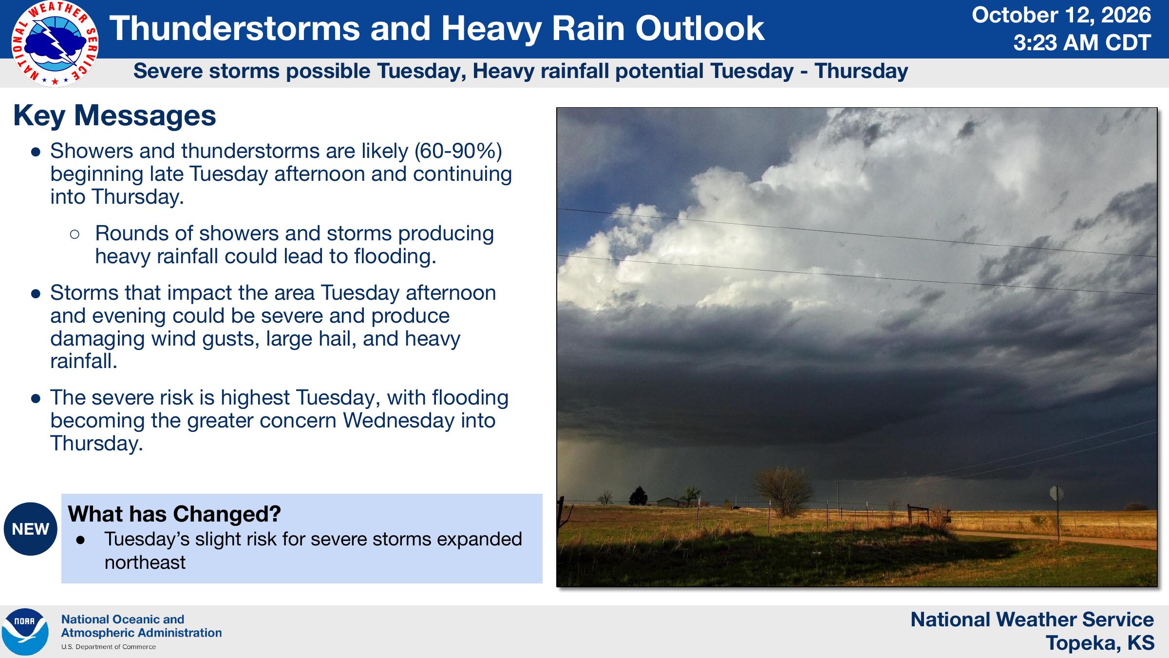
Severe thunderstorms could bring damaging winds, large hail and heavy rainfall to northeast and east-central Kansas Tuesday, followed by an increased risk of flooding Wednesday and Thursday.
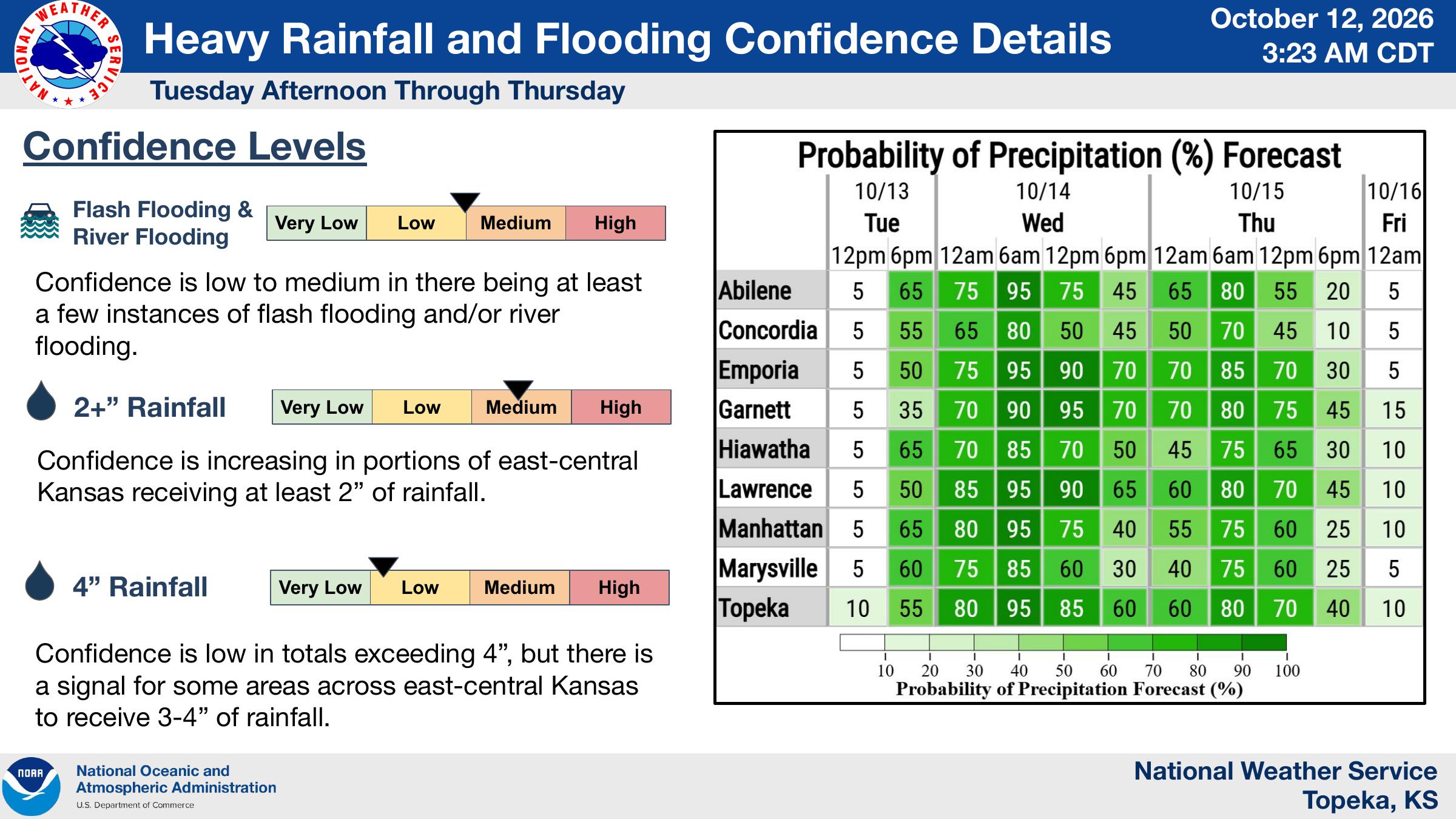
The National Weather Service in Topeka says showers and thunderstorms are likely beginning late Tuesday afternoon, with rain chances ranging from 60% to 90% through Thursday.
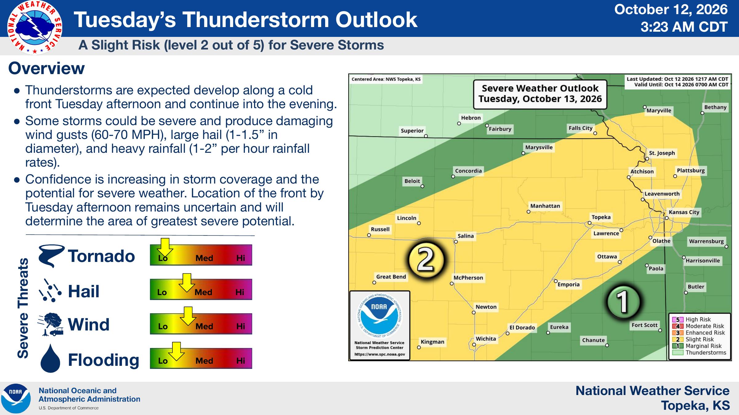
A slight risk, or Level 2 of 5, for severe thunderstorms is in effect Tuesday for much of the region, including Manhattan, Junction City and Topeka. Storms are expected to develop along a cold front Tuesday afternoon and continue into the evening.
Forecasters say some storms could produce wind gusts of 60 to 70 mph, hail between 1 and 1.5 inches in diameter and rainfall rates of 1 to 2 inches per hour. The location of the cold front will determine where the greatest severe weather threat develops.
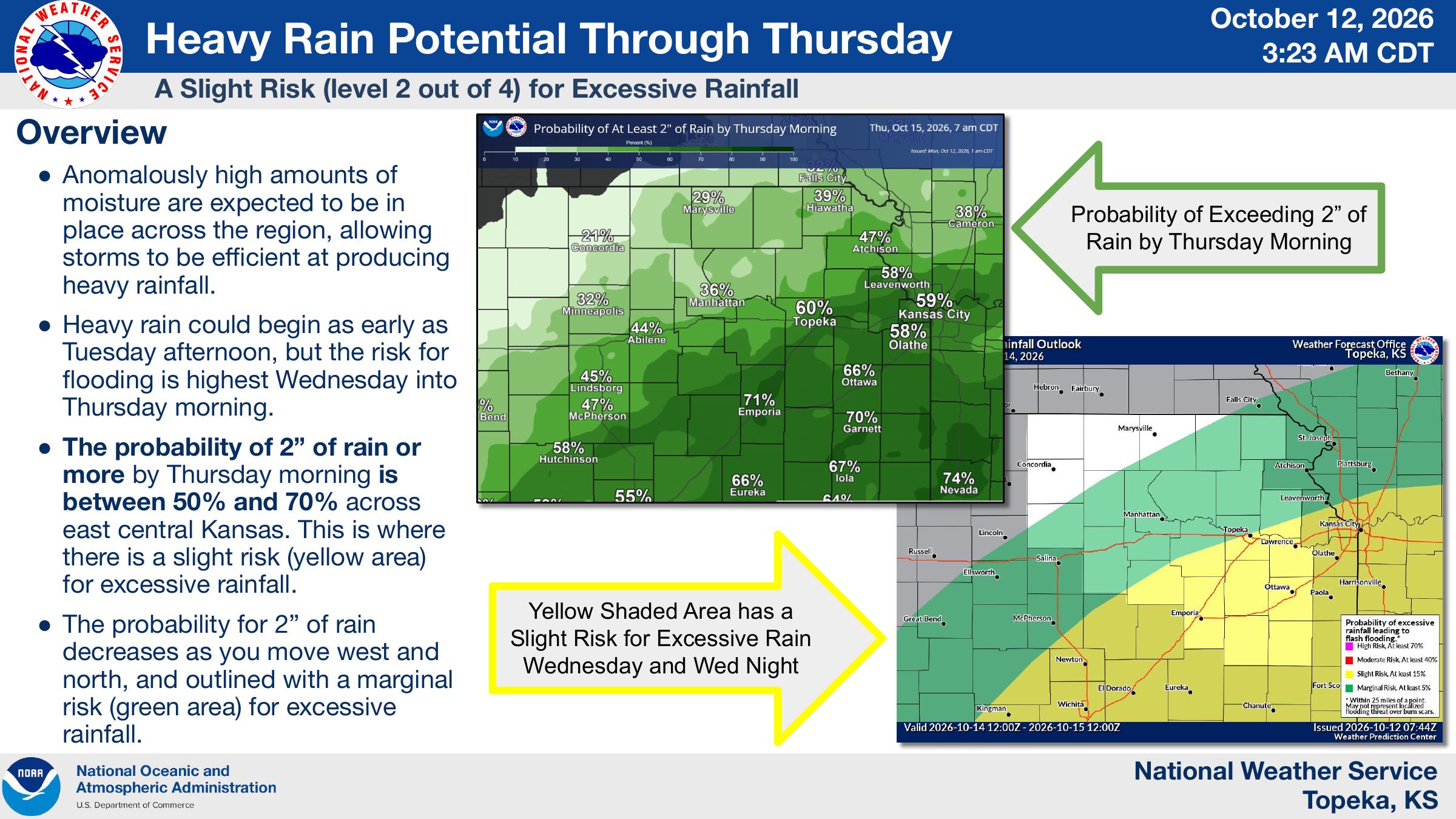
Heavy rainfall is expected to become the primary concern Wednesday into Thursday morning. The Weather Service says portions of east-central Kansas have a 50% to 70% chance of receiving at least 2 inches of rain by Thursday morning.
Manhattan has about a 36% chance of receiving at least 2 inches, according to the Weather Service’s forecast graphic. Some areas of east-central Kansas could receive 3 to 4 inches, although confidence in rainfall totals exceeding 4 inches remains low.
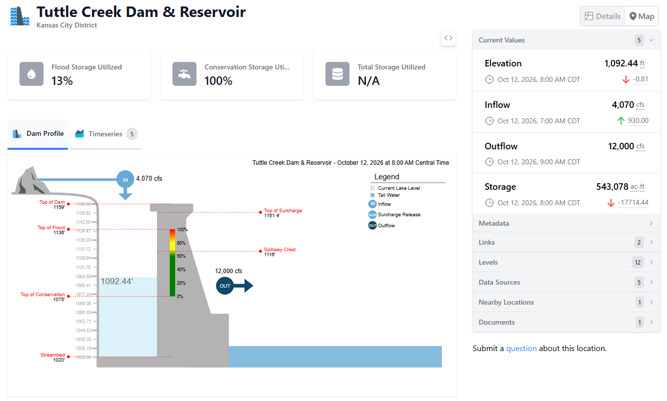
Meanwhile, the U.S. Army Corps of Engineers reported Monday morning that Tuttle Creek Reservoir was utilizing 13% of its flood storage capacity, with conservation storage at 100%.
As of 8 a.m. Monday, the reservoir’s elevation stood at 1,092.44 feet, down 0.81 feet from the previous reporting period. Inflows were measured at 4,070 cubic feet per second, while outflows were running at 12,000 cubic feet per second.
Stay tuned to News Radio KMAN for severe weather updates.