Northeast Kansas could see multiple rounds of heavy rainfall through Friday before hot and humid conditions return for the weekend, according to the National Weather Service in Topeka.
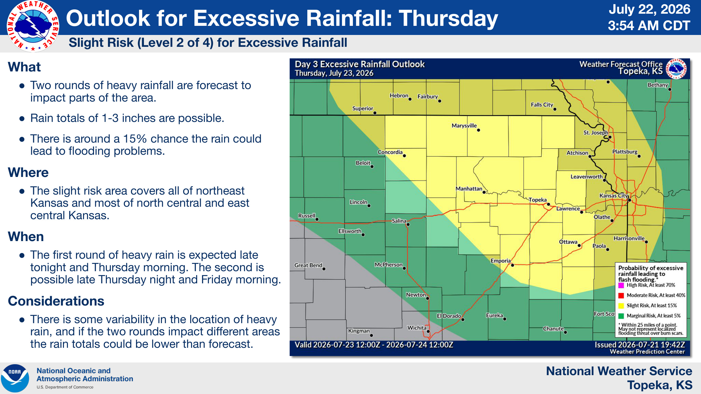
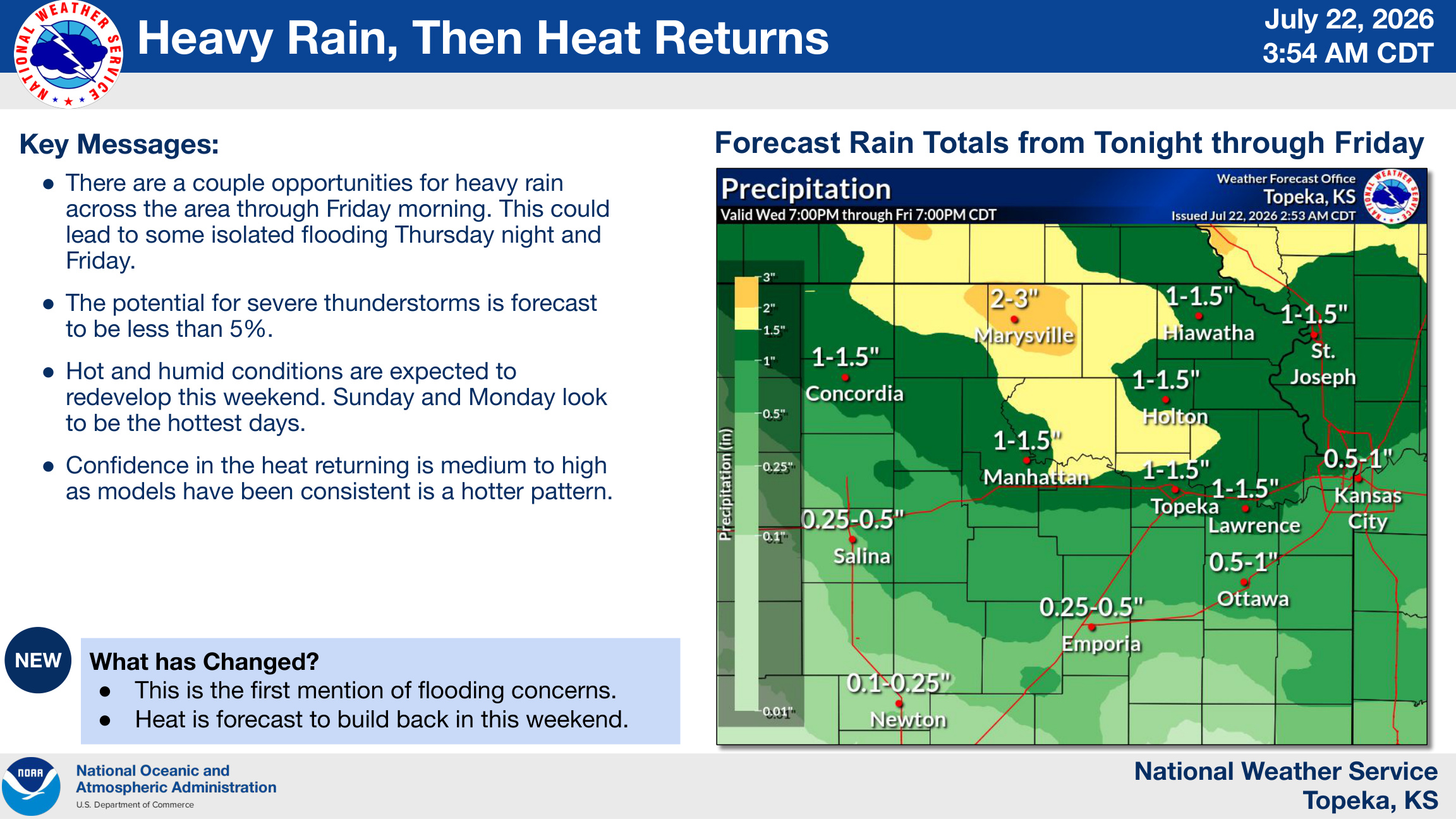
Forecasters say two rounds of thunderstorms are expected between Wednesday night and Friday morning, bringing widespread rainfall totals of 1 to 3 inches across much of the region. While the threat of severe weather remains low, the repeated rainfall could produce isolated flooding, especially Thursday night into Friday.
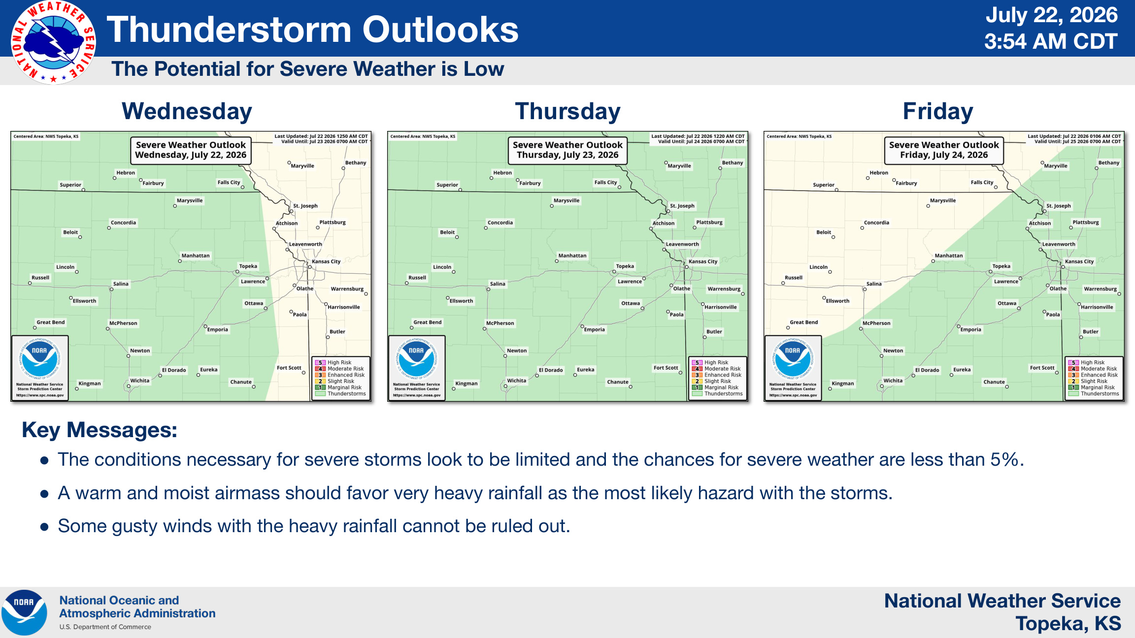
The National Weather Service said the chance for severe thunderstorms is less than 5%, with heavy rain expected to be the primary hazard. Some storms could also produce gusty winds.
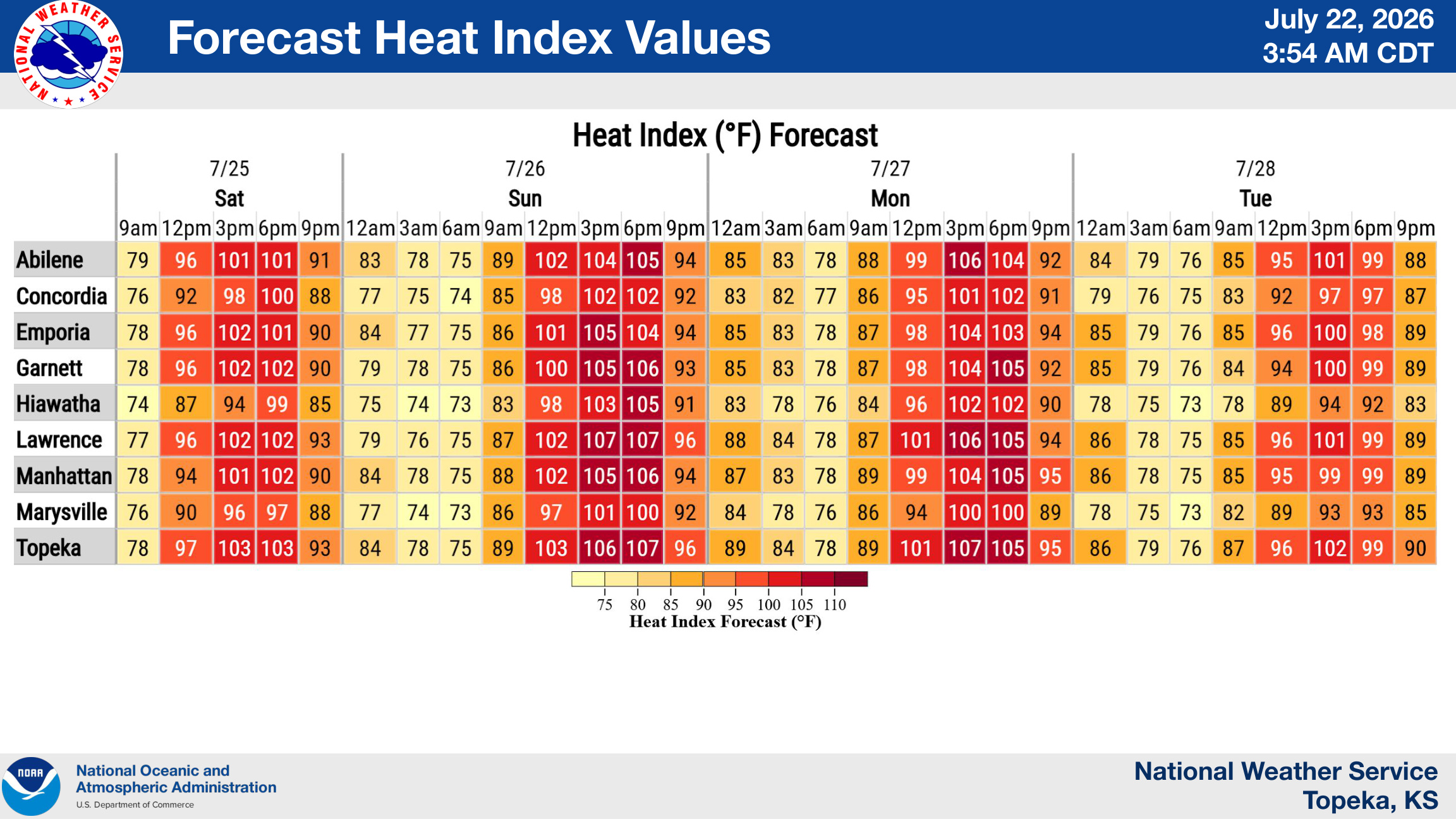
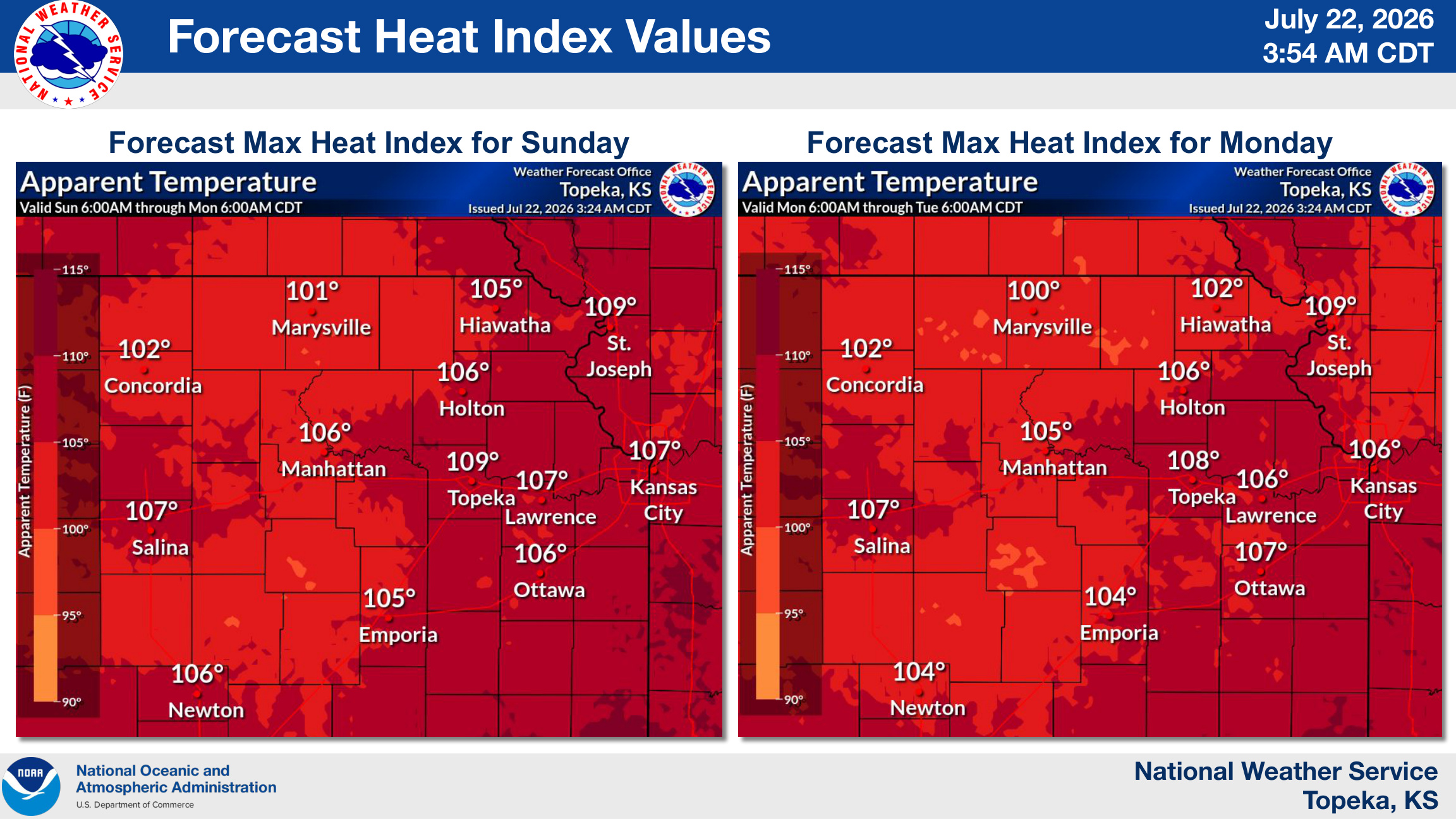
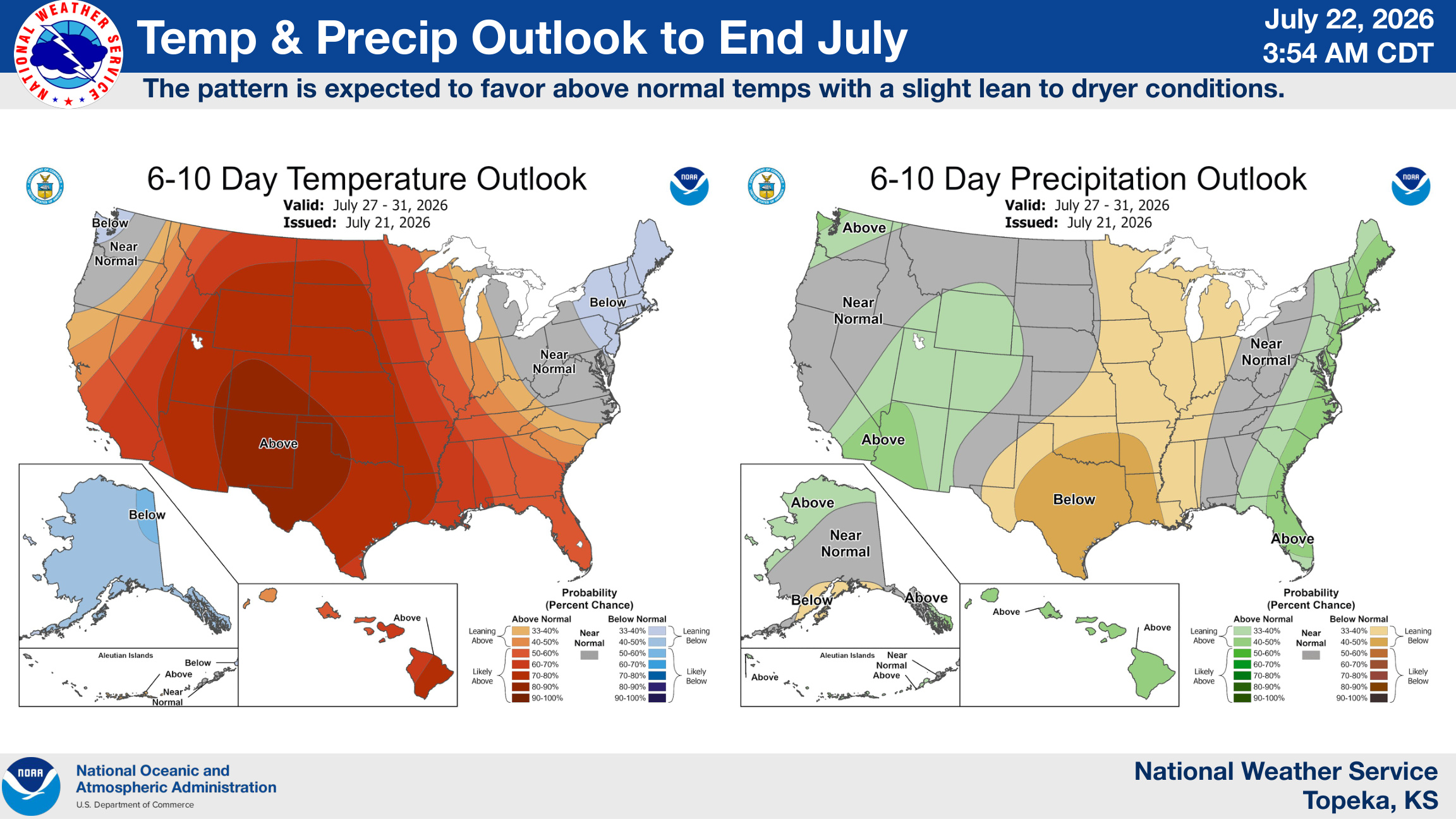
After the rain moves out, temperatures are expected to climb rapidly over the weekend. Forecasters expect heat index values to reach between 105 and 107 degrees Sunday and Monday across much of northeast Kansas, including around 106 degrees in Manhattan on Sunday and 105 degrees on Monday.