Northeast Kansas could see multiple rounds of severe weather beginning Thursday and continuing through at least Tuesday, according to the National Weather Service in Topeka.
Forecasters say a hot and humid air mass moving into the region will increase the potential for thunderstorms capable of producing large hail and damaging winds. While the severe weather threat remains conditional on storms developing, most areas in the region are expected to face at least some risk each day.
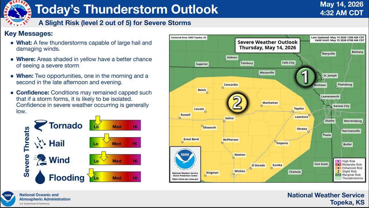
For Thursday, the Storm Prediction Center has placed much of central and northeast Kansas under a slight risk, or level 2 out of 5, for severe storms. The National Weather Service says isolated thunderstorms may develop during the morning, with another round possible later in the afternoon and evening. Large hail and damaging winds are the primary concerns.
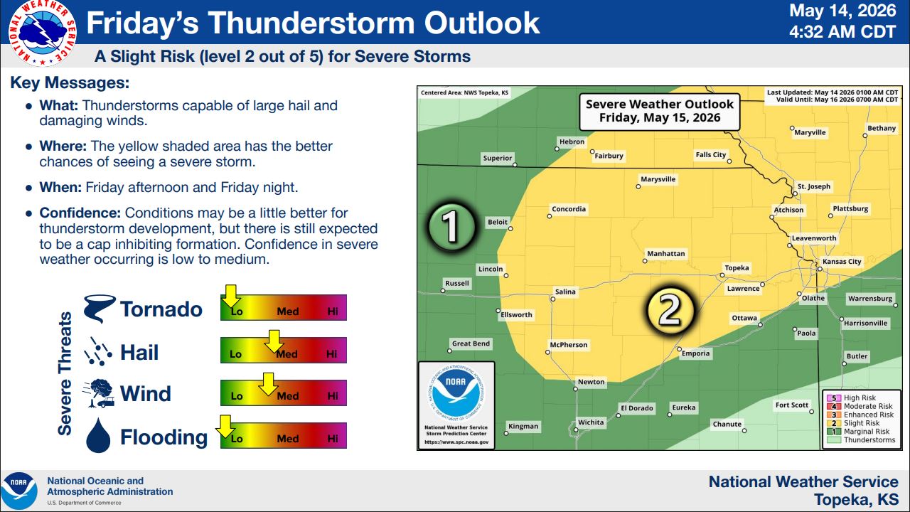
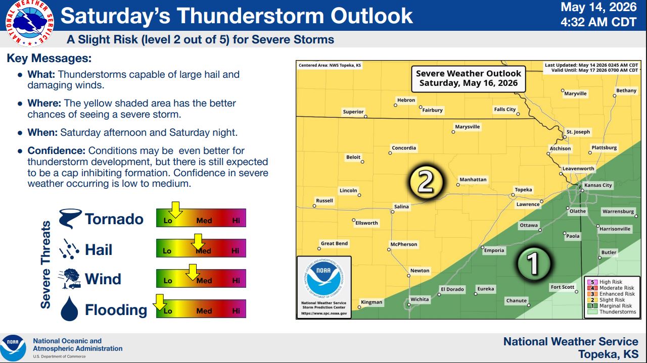
Additional slight risks for severe weather are forecast Friday and Saturday, with storm chances expected during the afternoon and evening hours both days. Confidence in storm development remains low to medium because of a cap in the atmosphere that could limit thunderstorm formation.
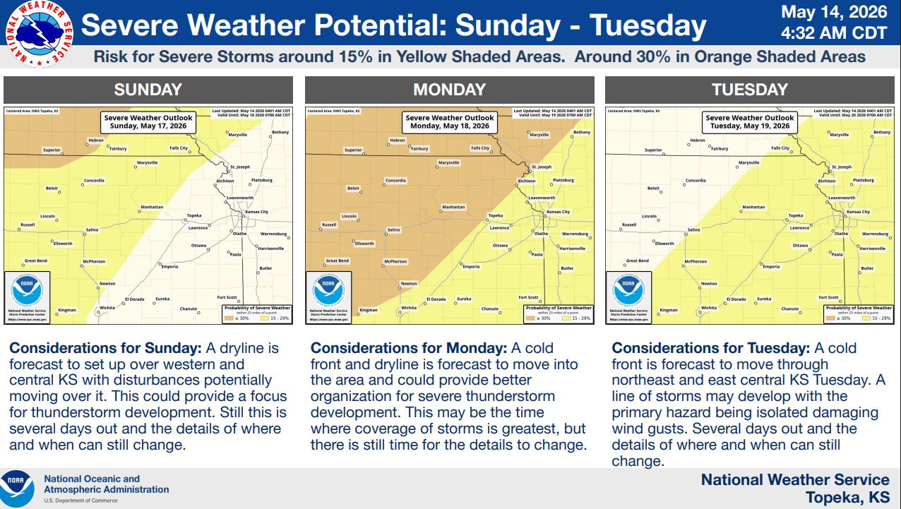
Looking ahead to Sunday through Tuesday, forecasters say the threat for severe weather may become more organized as a dryline and later a cold front move through the region. Monday currently appears to have the greatest potential for more widespread storm development. Tuesday’s primary threat may shift toward isolated damaging wind gusts along a line of storms.
The National Weather Service is encouraging residents with outdoor plans to stay weather aware and have multiple ways to receive warnings throughout the week.