
Tuesday’s storms were the third such strong wind event to impact the Flint Hills in the past two weeks and the first ever to hit Westmoreland directly, in what’s been an active few weeks for severe weather.
On April 18, a downburst struck St. Marys, and while it wasn’t classified as a tornado, it did produce wind gusts of 80 to 90 mph. On April 27, tornado warnings were issued across portions of northern Riley and Pottawatomie Counties, but it wasn’t until after those storms moved out that a wake low caused significant wind damage in the Manhattan area. National Weather Service-Topeka meteorologist Matt Flanagan says Tuesday’s tornado in Westmoreland was a low precipitation super cell, one of less than a handful to impact northeast Kansas.
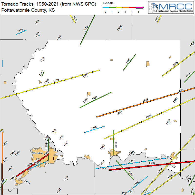
According to National Weather Service records, Tuesday’s storm was the first confirmed tornado to impact Westmoreland. In 1993, a tornado was confirmed just south of the city. That year was an active one, with three tornadoes occurring on May 6, June 13 and July 4. Those were also the most costly storms each totaling over a half million dollars in damage.
An EF-1 tornado went just southeast of Westmoreland in 1951. Records show Pottawatomie County has had a little more than two dozen tornadoes since 1950 (or about one every three years).
Perhaps the most active day in the county’s history occurred on June 11, 2008, the same day that an EF-4 tornado struck Manhattan. Two tornadoes were also confirmed that day around the Flush area and just south of Havensville.
Tuesday’s storm included the first recorded death in the county’s history due to a severe weather. Prior to Tuesday, just five injuries had been recorded, all stemming from an incident in October 1979, according to Kansas Mesonet Manager and meteorologist Chip Redmond.
